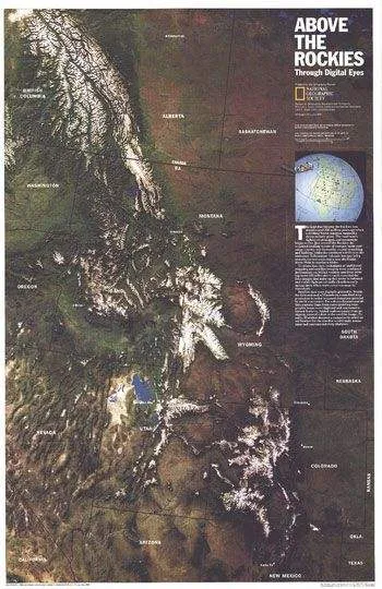
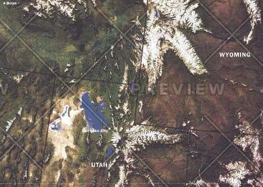
NOAA satellite imaging formed the basis of this fascinating map of the Rocky Mountain region which was then computer-enhanced by WorldSat International of Canada.
Published in July 1995, this map accompanied the Heart of the Rockies tourist map.


$ 0.00
$ 30.00
NOAA satellite imaging formed the basis of this fascinating map of the Rocky Mountain region which was then computer-enhanced by WorldSat International of Canada.
Published in July 1995, this map accompanied the Heart of the Rockies tourist map.
$ 25.00
$ 58.44
$ 44.95
$ 74.01
$ 56.93
$ 17.00
$ 56.08
$ 43.14
$ 12.99
$ 30.00
$ 32.98
$ 16.99
$ 80.77
$ 62.13
$ 35.48


